Tag Archives: skidaway institute

Scientists and students participate in Hawaii research cruise

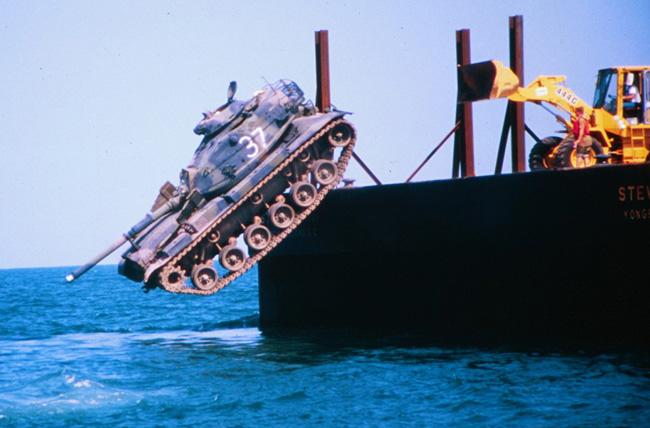
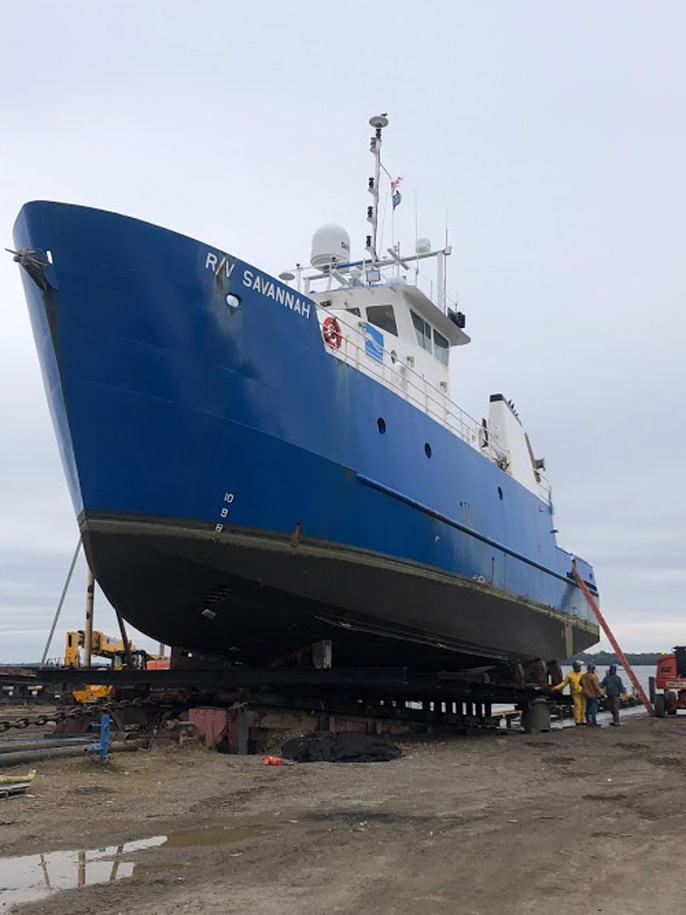
After two years of delay due to the COVID-19 pandemic, University of Georgia Skidaway Institute scientists participated in the first cruise of their four-year project to study how dust in the atmosphere is deposited in the ocean and how that affects chemical and biological processes there. The team of Daniel Ohnemus and Chris Marsay, along with graduate students Charlotte “Charlie” Kollman and Mariah Ricci, joined the University of Hawaii Research Vessel Kilo Moana on a cruise out of Oahu. They collected samples at the Hawaii Ocean Time-Series Station Aloha – a six-mile wide section of ocean approximately 122 miles from Oahu – where oceanographers from around the world study ocean conditions over long time spans. The cruise was the first of six planned during the four-year project.

Research Vessel Kilo Moana

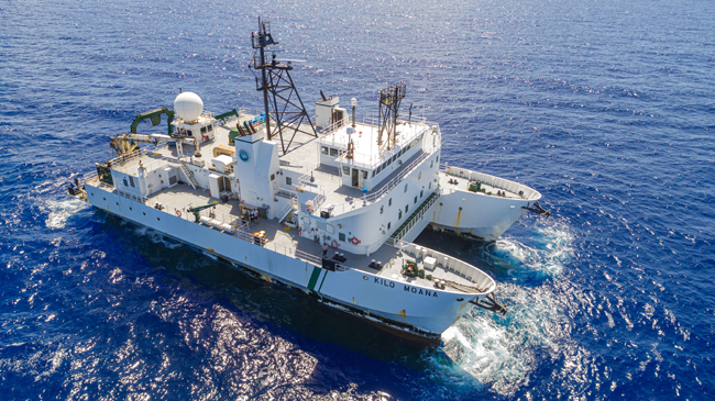
Ohnemus is one of two chief scientists on the project along with fellow UGA Skidaway Institute researcher Clifton Buck, who did not join this cruise. He called the cruise a success.

“Everything we put in the ocean, we got back, and that’s a good thing in oceanography,” he said. “And also, most importantly, it all worked.”

The overall goal of the project is to look at the rate at which dust is deposited into the ocean and what happens to it once it is in the water column. The chemistry of the ocean can be changed by the introduction and removal of elements, including trace elements which are present in low concentrations. In some cases, these elements are known to be vital to biological processes and ocean food webs.
After waiting for two years for the pandemic to ease, the science team still had additional waiting once they arrived in Hawaii. They were required to quarantine in a hotel for six days before being allowed to board the ship.

“We flew in about a week before we were expected on the ship. We got tested multiple times,” Ohnemus said. “We tested at the airport. We got a PCR test mid-quarantine. And we were tested again before boarding the ship.

“We knew we definitely did not have COVID.”

Mariah Ricci, Charlie Kollman and Dan Ohnemus prepare to deploy an instrument package.

“The hardest part is that we were out there for five days and four nights, and all of our research and sampling took place in the last eight hours of the cruise,” Ohnemus said.

For the students Charlie Kollman and Mariah Ricci the cruise was a new experience. It was Ricci’s first research cruise ever. Ironically, she and Ohnemus both took their first cruise on the RV Kilo Moana, only their cruises were 15 years apart.

Dan Ohnemus and Charlie Kollman deploy a package of sensors.

For Kollman, the best part of the cruise was participating in all the work necessary to conduct the science activity from the planning process all the way through to the end and then seeing the fruits of her labor.

“It was a great experience,” she said. “It is really rewarding to see all the different things we had to do like all the mechanical work.

“I think people often think of science as being constantly high value or in the lab doing really complicated stuff, but a lot of times it’s running to Home Depot four times because you don’t have the correct pipe fitting.”

Ohnemus sings the praises of his collaborators at the University of Hawaii. “They are excellent. It was great to be able sail with them after all this time,” he said. “We first wrote the proposal in 2018, and to actually get to sail together four years later was very rewarding and time well spent.”

Hurricane glider completes marathon mission

By Nadine Slimak and Michael Sullivan

When the Slocum glider known as NG645 was deployed about 80 miles south of New Orleans on Oct. 10, 2021, it became one of the most closely watched ocean-observing instruments in the Gulf of Mexico. That’s because it was a small robot with a big mission – to investigate features of the Loop Current and Loop Current Eddies in the Gulf as part of the Hurricane Glider Project – then navigate on a mission never attempted by an unmanned glider before.

“Our goal with this project was to deploy a glider in the Gulf of Mexico and then navigate it through the spatially variable currents of the Loop Current and into the Gulf Stream all the way around the bend of Florida up to the coast of South Carolina,” said UGA Skidaway Institute of Oceanography researcher Catherine Edwards, one of the glider team leaders and who was responsible for the glider once it rounded the tip of Florida.

The glider path is shown in red from the Gulf of Mexico to the Atlantic Ocean off the coast of South Carolina.

The trip was a test to see whether the glider could successfully navigate around Florida and up the East Coast while gaining information about multiple marine systems – all during a single mission. With no propeller or motor, it would have to do so using minimal battery power and only buoyancy to travel.

Slocum gliders, also known as autonomous underwater vehicles (AUVs), are torpedo-shaped underwater robots about six feet long and eight inches in diameter that carry instrument packages to gather data on water temperature, salinity, dissolved oxygen and other ocean parameters, depending on ocean-observation needs. The gliders use buoyancy to move throughout the water column in a vertical yo-yo pattern, taking in water to move down through the water column and expelling water to return to the surface. The wings on the glider then give it lift that allows it to move forward. When the glider surfaces, it sends data to a satellite, which beams it back to scientists in the lab. Back in the laboratory, glider pilots can update and adjust glider trajectories to ensure they remain on course, or even change their paths.

NG645’s initial mission was to gather information on the Loop Current and Loop Current Eddies, major oceanographic features in the Gulf of Mexico.

“The Loop Current is sort of an arm of the western boundary current that eventually becomes the Gulf Stream,” Edwards said. “That’s one of the major features that this project seeks to capture. Just like we’re monitoring the edge of the Gulf Stream with our gliders, these are areas where the models need the most improvement, and where our observations can have the greatest impact.”

The glider is recovered off the coast of South Carolina.

The glider was a part of the Hurricane Glider Project, a series of gliders monitoring the ocean in the Gulf, Caribbean Sea and Atlantic that are programmed to collect information on ocean parameters from areas where tropical storms and hurricanes typically form or strengthen. Gliders gather temperature and salinity readings from throughout the water column, not just at the surface, and send it back to the National Oceanic and Atmospheric Administration in near-real time to improve the accuracy of upper ocean models used to create hurricane intensity forecasts. This was the first-time glider operators attempted such an ambitious mission.

“There were so many firsts during this mission,” said Kerri Whilden, a researcher from Texas A&M University, who led the collaboration in the Gulf before handing it off to Edwards as it rounded Key West and navigated up the East Coast. “It would be the first time we started piloting a glider in the Gulf and then sent it through the Gulf Stream around the tip of Florida, then on to South Carolina. It involved coordinating a lot of different organizations to deploy the glider, to pilot it and then to retrieve it at the end of its mission. It was a big team collaboration for sure.”

In addition to UGA Skidaway Institute and Texas A&M, other partners in the project included the Naval Oceanographic Office, the U.S. Integrated Ocean Observing System, the Gulf of Mexico Coastal Ocean Observing System, the Southeast Coastal Ocean Observing Regional Association, the Underwater Glider User Group, the University of Southern Mississippi, NOAA’s Atlantic Oceanographic and Meteorological Laboratory and the Woods Hole Oceanographic Institute.

Planning is under way for a repeat mission in 2022.

Semester@Skidaway brings undergrads to UGA Skidaway Institute

The fall semester 2022 marks a major milestone in the growth of the University of Georgia Skidaway Institute’s education mission beyond its historical role as a research laboratory. The Semester@Skidaway domestic field study program is a significant part of the UGA Department of Marine Sciences new undergraduate ocean sciences major. A small cohort of ocean sciences majors are spending the entire fall semester in residence at UGA Skidaway Institute taking classes and learning how to conduct marine research.

Assistant professor Sara Rivero-Calle teaches one of the undergraduate courses with students at Skidaway Institute and in Athens, as seen in the monitor.

The Semester@Skidaway serves, essentially, as a capstone type experience for students before they graduate,” said Semester@Skidaway program director Clifton Buck. “The students have the opportunity to take a number of courses that are taught here, but also they have the chance to take courses that are much more immersive and hands on.”

The research-based activities include field surveys, collecting samples from the environment, returning them back to the laboratory and analyzing them for chemical, biological and physical parameters.

“They make a scientific journey from actually being out in the field and then into the laboratory, to analyze the data and think about it critically” Buck said.

Semester@Skidaway students (l-r) Taylor English, Dillon Doomstorm, Ava Meier and Sarah Belcher

The students take five three-credit courses that cover a wide range of marine science topics including data analysis techniques and marine science field methods. They also study the unique South Atlantic Bight system located off our coast under the instruction of associate professor Catherine Edwards. A highlight of the semester will be a cruise aboard the Research Vessel Savannah. Professor Jay Brandes teaches a course that focuses on the planning and preparation needed for a successful research cruise.

“They’ll go on a two-day cruise just offshore and collect samples, apply some of the things they’ve learned in the laboratory class and bring those samples back and work with them,” Buck said. “And so again, they will take it from the planning stage through the execution, through the sample analysis and data interpretation.”

The fall 2022 group consists of just a handful of students. As the ocean sciences major grows, Buck expects later cohorts to include about 24 students.

“The Semester @ Skidaway program brings highly motivated ocean science majors to the Skidaway campus to experience hands-on and research-based instruction,” UGA Skidaway Institute Director Clark Alexander said. “This influx of young, enthusiastic students enhances the programs at Skidaway by their presence, and we are excited to be teaching tomorrow’s scientists and informed citizens.”

Cutting edge survey charts Georgia’s artificial reefs

– Beginning in 1970, the Georgia Department of Natural Resources built a series of artificial reefs to provide habitat for marine life. However, until recently, there were gaps in some of the key information about those reefs, such as the precise locations of the materials placed on the bottom and water depth over the materials. Now, researchers at the University of Georgia Skidaway Institute of Oceanography are using cutting-edge bathymetric side-scan sonar and high-resolution geographic positioning systems (GPS) to provide coastal managers and fishermen a detailed picture of the location and condition of reef materials.

Georgia’s shelf is relatively shallow and extends approximately 80 miles offshore before dropping into the deep ocean. Most of the shelf bottom consists of shifting sand, which does not provide the kind of conditions to develop and support diverse reef communities.

“Much of the continental shelf is like a vast sandy desert,” UGA Skidaway Institute scientist Clark Alexander said. “So, what we need is more hard substrate, because that is really the most important thing for establishing stable live-bottom communities.”

A battle tank is pushed into the ocean to form part of an artificial reef. Photo credit: Georgia DNR.

Over the past 50 years, the state has placed hard-surface materials in 18 sites, each about 15 square kilometers in size. Eight of the sites are located along the coast approximately 10 miles off shore and another eight approximately 25 miles off shore. There are also two “beach reefs” that are closer to shore and accessible to fishermen with smaller boats. The reefs are made up of a wide range of materials, including old ships, battle tanks, pieces from the original Talmadge Bridge, retired subway cars from New York City, concrete pipes and pilings, and purpose-built, concrete tetrapods.

“The materials that were placed on the bottom in the 1970s and 1980s were sunk in place or deployed from barges using Loran-C, a radio-based navigation system that was significantly less accurate than current GPS, or dropped from Army helicopters, so their precise locations are not always exactly known,” Alexander said. “In addition, we have had a number of hurricanes and winter storms come through or offshore Georgia, and we don’t know whether some of the material has been moved from its original location.”

Alexander proposed a program to survey the reefs and develop a more accurate set of data on their locations and characteristics, which was subsequently funded through the Georgia Coastal Management Program, administered by the Georgia Department of Natural Resources Coastal Resources Division.

Marine life attracted to one of Georgia’s artificial reefs. Photo credit: Georgia DNR.

“Our goals were to document the status of what is on the bottom, and to give more precise locations for the objects we identify,” Alexander said. “We used real-time kinematic GPS, so we know within a few centimeters where things are on the bottom.”

Alexander’s team began field work in 2018 and continued into 2021, using the 28-foot RV Jack Blanton. They spent an average of six days surveying each reef. They started with the beach reefs to work out any kinks in the planned survey approach and then moved on to the reefs 10 miles off shore. Along with high-resolution GPS, the team used an interferometric side-scan sonar that gives the depth and co-registered side-scan sonar imagery that provides images of the seafloor and objects sitting on it.

“Based on an object’s general location, and existing location data, we were able to make some good guesses as to ‘Oh, that must be a certain barge or ship’ and so on,” he said. “And we found a few objects that were not on existing maps and several others that had fragmented into several pieces since being placed.”

Another important parameter the team measured was the amount of clearance between the various structures and the ocean surface.

“You don’t want to have to worry about anything you put down being a hazard to navigation,” Alexander said. “Ten kilometers off shore, you are in about 10 meters of water or so, about 30 feet. So, if one of these sunken vessels was sticking up a significant height above the bottom, that is something you need to know.”

Alexander and DNR are making plans to survey the eight reefs that are about 25 miles off shore. They present a greater challenge than the reefs closer to shore. The longer distance means greater transit time and less time on-station actually conducting the survey. The team would also be constrained by the weather. Conditions must be very good and forecast to remain calm throughout both the transits and survey.

“Because when you are that far offshore, you are at the mercy of sea conditions, which can change quickly” Alexander said.

The data Alexander’s team collected is now being added to the DNR’s marine artificial reef fishing website. These new data products enhance the data available to anglers, and now allows users to zoom in to the individual features, see what they look like, and how they are distributed in relation to other features on the bottom. The data collected by the project can be found on the DNR’s artificial reef website: https://coastalgadnr.org/HERU/offshore

R/V Savannah gets an overhaul

By John Bichy, Marine Superintendent

As part of the R/V Savannah’s biennial maintenance schedule, the ship was hauled out at Stevens Towing shipyard on February 17. Located on Young’s Island, S.C., near Charleston, the shipyard is close to the ship’s home port on Skidaway Island and offers top quality commercial yard services.

These shipyard periods are necessary to conduct maintenance projects that can only occur when the vessel is out of the water. This year’s projects are routine with the primary scope of work to resurface the bottom shell and top side shell coatings. Other projects include replacing the port shaft seal and standard gauging of the hull plate to measure steel thickness.

A good portion of work is conducted by the ship’s crew. Crew projects this year include, resurfacing the exterior decks, rails and superstructures; cleaning fouled pipes; and installing equipment such as a new replacement satellite communications antenna for the ship’s Fleet Express broadband internet service, to name a few. The crew understands this is a critical time for maintenance. It’s their home for much of the year, and they take a great deal of pride in making her the best platform she can be.

New equipment system expands UGA Skidaway Institute’s research capability

A new equipment system is providing researchers at the University of Georgia Skidaway Institute of Oceanography greater capability to study the extremely rare, but essential chemicals in the ocean.

Trace elements, like iron, cadmium and zinc appear in the ocean in very small concentrations, yet they are vital for many oceanic processes. For example, the relative abundance or scarcity of iron is often the limiting factor for the growth of microscopic marine plants known as phytoplankton. These single-cell marine plants serve as the base of the marine food web and also produce about half the oxygen in our atmosphere.

According to UGA Skidaway Institute scientist Clifton Buck, measuring and studying trace elements in the ocean is a significant challenge.

“The concentrations we’re talking about are just so incredibly small, down to parts per billion and parts per trillion, and, so, one of the of the challenges that we face is how to collect water samples in a way that we don’t introduce contamination into the water that we’re trying to collect,” Buck said.

Buck, fellow UGA Skidaway Institute researcher Daniel Ohnemus and marine superintendent John Bichy applied to the National Science Foundation for funding to obtain a system of highly specialized equipment that will give UGA Skidaway Institute’s Research Vessel Savannah the capability of collecting contaminant-free samples in coastal waters. The system–manufactured by SeaBird Scientific–is based on a frame, called a rosette. The rosette is built of aluminum and titanium components which greatly reduces the contamination risk because these metals do not readily dissolve in seawater. The frame itself is also “powder coated” to provide additional protection. It can collect water samples from as deep as 2,000 meters. The rosette holds 12 plastic collection bottles that can be triggered to close by sending electrical signals from the surface. It also carries a number of sensors that measure characteristics such as pressure, temperature, salinity, oxygen concentration and more.

The trace metals rosette in its packing crate.

“So that really gives us a lot of power now, to be able to do relatively high-resolution sampling of the waters around the South Atlantic bight and out to the Gulf Stream, using the RV Savannah as a platform,” he said.

Buck and his colleagues are also working with Woods Hole Oceanographic Institute, which is building a specially designed winch with a dedicated non-metallic cable.

The system will be available for use by scientists outside of UGA Skidaway Institute. Researchers can use the R/V Savannah through the University-National Oceanographic Laboratory System to study coastal waters from Chesapeake Bay to the western Gulf of Mexico. They can also request the equipment be shipped to them to use temporarily on their own research vessels.

Equipping the R/V Savannah, which typically operates in continental shelf waters, reflects a shift in focus for Buck and the trace elements community as a whole. In the past, the emphasis of most trace element research was on the deep ocean, with lengthy transect cruises, thousands of miles long, that mapped trace elements across a wide stretch of ocean.

“Trace element scientists are really starting to focus more along the margins, things like rivers,” Buck said. “And the actual continental shelf sediments themselves are big influences on trace elements and as a supply and as removal functions.

“So, we are getting into using smaller ships going into shallow water, and doing what we call process studies, wherein you identify some sort of process that you think might be happening in a region, and you spend some time there to, to really kind of tease out the relationships, whatever they may be.”

The project is funded by NSF grant 2015430 totaling $182,625.

Evening @ Skidaway lecture series returns in virtual format

After a lengthy hiatus due to the COVID-19 pandemic, the University of Georgia Skidaway Institute of Oceanography resumed its 2021 Evening @ Skidaway speaker series in February. The talk was the first of 11 Evening @ Skidaway programs to be presented through November.

The programs were initially presented via Zoom, but were subsequently moved to UGA Skidaway Institute’s YouTube channel and will begin at 7 p.m. Evenings @ Skidaway will continue to be presented virtually until it is possible to safely resume in-person gatherings.

Tuesday, April 13 – Dan Ohnemus, “A Look at Climate Mitigation Solutions: Ideas for the Century Ahead”

Tuesday, May 18 – Adam Greer, “The Secret Life of Ocean Critters”

Tuesday, June 8 – Clifton Buck, “Is it the Sun? Skepticism and Myth Making in Climate Science”

Tuesday, July 13 – Catherine Edwards, “Alexa, Map Fish Habitats! Artificial Intelligence for Robotic Fisheries Management”

Tuesday, August 10 – Open Lab Night, Labs TBA

Tuesday, September 14 – Clark Alexander, “I’m all shook up – Earthquakes and Tsunamis”

Tuesday, October 12 – Marc Frischer, “Climate Change and Shrimp Black Gill – Is There A Connection?”

Tuesday, November 9 – Jay Brandes, “The Ocean’s Plastic Problem – A Very 21st Century Pollutant”

For additional information, contact Michael Sullivan at (912) 598-2325.

New weather station goes online

UGA Skidaway Institute’s new weather station became operational in early May.

The weather station includes a 30-foot-tall tower on the pier at Priests Landing. It has a Gill Instruments GMX531 Weather Station, collecting wind direction and speed, air temperature, relative humidity, atmospheric pressure, solar radiation and precipitation at five minute intervals. The station is powered by a solar panel, and data is sent by a cellular link to a website for display. This installation is part of a National Weather Service-funded effort to improve regional weather forecasts.

The available current and historic data can be accessed HERE. Select “Skidaway 1,” which is the 14th station on the list.
Weather Station 650p


UGA Skidaway Institute’s Edwards granted tenure

The University of Georgia has granted tenure to UGA Skidaway Institute of Oceanography / Department of Marine Sciences scientist Catherine Edwards. Edwards was also promoted from assistant professor to associate professor, effective Aug. 1.

OLYMPUS DIGITAL CAMERAEdwards is a physical oceanographer, with broad interdisciplinary interests in marine sciences and engineering. She earned a B.S. in physics with highest honors from the University of North Carolina at Chapel Hill, and worked as an ocean modeler at the U.S. Naval Research Laboratory before earning her Ph.D. in physical oceanography from the University of North Carolina at Chapel Hill. She joined Skidaway Institute in 2010.

Edwards’ research focuses on answering fundamental questions in coastal oceanography and fisheries sciences with autonomous underwater vehicles (AUVs). Using AUVs, also called gliders, she and her team are developing novel ways to optimize their use with engineering principles and real-time data streams from models and observations.

While at UGA Skidaway Institute, Edwards has been awarded more than $2 million dollars on 12 projects totaling more than $12 million from NOAA/Navy sources, the Gulf of Mexico Research Initiative and four different programs within the National Science Foundation. As the founder of a regional glider observatory, she serves as the lead scientist in a new project that places gliders in the paths of hurricanes to better predict their intensity at landfall. Edwards is a co-primary investigator in a large $5 million observational program studying exchange between the coastal and deep ocean at Cape Hatteras. In an effort funded by NSF’s Smart and Autonomous Systems program, Edwards is also working with researchers from Georgia Tech and Gray’s Reef National Marine Sanctuary to utilize gliders and acoustic tagging to track fish migrations.

Scientific serendipity: Researchers make surprising finding on ocean’s ‘thin layers’

Sometimes scientists start out researching one subject, but along the way, they come across something else even more interesting. This is what happened to University of Georgia Skidaway Institute of Oceanography researcher Adam Greer in the summer of 2016 when Greer was a post-doctoral associate at the University of Southern Mississippi. That fortuitous event resulted in a paper recently published in the journal Limnology and Oceanography with Greer as the lead author.

Adam Greer 1 650p
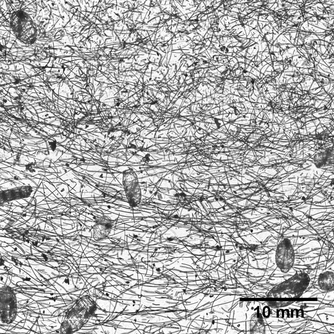
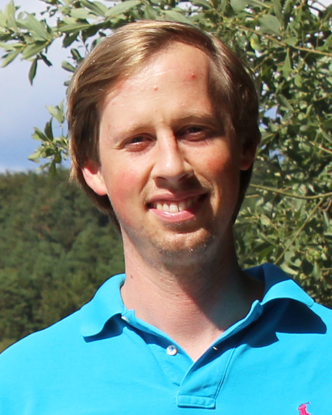
Greer and his fellow researchers were on a cruise in the northern Gulf of Mexico to study the effects of river input on biological processes. They came across a natural phenomenon called a thin layer. These are oceanographic features found all over the world where biomass collects into a narrow portion of the water column–less than five meters thick vertically–and can extend for several kilometers horizontally. They tend to occur in stratified shelf systems.

“Surprisingly, there are few published studies on thin layers in the northern Gulf of Mexico, which is heavily influenced by rivers and highly stratified during the summer,” Greer said. “Thin layers are important because they are trophic hot spots, where life tends to congregate, and predators and prey interact.”

However, Greer said, thin layers are very difficult to analyze because they occur within a restricted portion of the water column, and most conventional ocean sampling equipment will not detect their influence on different organisms.

Greer and his colleagues were better equipped than most to study the thin layer. Rather than laying out a grid and taking a series of water samples, they were equipped with an In Situ Ichthyoplankton Imaging System (ISIIS). This imaging system was towed behind their research vessel and undulated through the water column, producing a live feed of plankton images and oceanographic data. By studying the video, they were able to map the distributions of many different types of organisms in great detail. The thin layer was composed of large chains of phytoplankton called diatoms and gelatinous zooplankton called doliolids.

Thin Layer 2

A crewman launches the ISIIS.

“Although we expected many different organisms to aggregate within the layer, this was not the case,” Greer said. “The only organisms that were concentrated within the layer were gelatinous organisms called doliolids. Other organisms that we expected to see, such as copepods, chaetognaths and shrimp, tended to congregate near the surface just south of the thin layer.”

The researchers determined that the area south of the thin layer was influenced by a surface convergence – two water masses colliding and pushing water downward at a slow rate. They believe that many organisms with active swimming ability, such as shrimps and copepods, could stay within the surface convergence, while more passive swimmers, such as doliolids would follow the trajectory of the thin layer and diatoms.

Thin Layer 1

An image from the In Situ Ichthyoplankton Imaging System passing through the thin layer. The long, slender filaments are chains of diatoms. The larger, oval plankton are doliolids

Greer and his colleagues discovered several other characteristics of the thin layer they had not anticipated. There was a higher concentration of live phytoplankton than expected. As a result, the thin layer also had a high concentration of dissolved oxygen due to the photosynthetic activity. The zooplankton were also aggregated into distinct microhabitats with different oceanographic properties — such as temperature, salinity and light. The microhabitats also contained different types and abundances of food.

“For a lot of these organisms, if you took the average abundance of food it wouldn’t be enough to survive,” Greer said. “So whatever mechanisms there are to create higher abundances of food, they are potentially really important for a number of different organisms.”

The other members of the research team were Adam Boyette, Valerie Cruz, Kemal Cambazoglu, Luciano Chiaverano and Jerry Wiggert, all from the University of Southern Mississippi; Brian Dzwonkowski and Steven Dykstra, from the University of South Alabama; and Christian Briseño‐Avena and Bob Cowen, from Oregon State University.
The paper can be viewed HERE.