
JoCasta Green became a teacher after she was told as a child she couldn’t be a scientist because she was a girl. In May, the pre-K teacher from Decatur, Georgia, achieved a small piece of her childhood dream by joining a research cruise on board the University of Georgia Skidaway Institute of Oceanography’s Research Vessel Savannah. Green was one of two teachers on the overnight cruise, some of the first to participate in a cooperative program between UGA Skidaway Institute and Georgia Southern University’s Institute for Interdisciplinary STEM Education (i2STEM).
“Because I am an elementary teacher, I was afraid that maybe I shouldn’t have applied,” Green said. “However, once I got here and everyone was so interested and wanted to share, I really did learn a lot.”
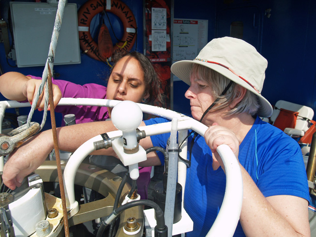
JoCasta Green (right) learns how to prepare a conductivity-temperature-depth sensor array for deployment with the help of Natalia Lopez Figueroa from Hampton University.
UGA Skidaway Institute scientist Marc Frischer led the cruise with the aim to hunt, collect and study doliolids — a small gelatinous organism of great significance to the ecology and productivity of continental shelf environments around the world. Green and middle school teacher Vicki Albritton of Savannah were the only teachers on board and were able to actively participate in the research activities.
“I think giving any teacher the opportunity come to out to sea is an amazing experience,” Frischer said. “I think it’s transformative, but to have them integrated into the research, we haven’t really done that before.”
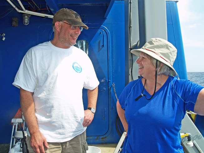
Marc Frischer chats with JoCasta Green during the cruise.
Green and Albritton participated in the deck activities. They helped launch the CTD (conductivity-temperature-depth) sensor packages mounted on heavy metal frames and deployed plankton nets that concentrated a wide variety of tiny marine creatures into a small container. The two teachers then worked with the science team in the darkened wet lab to sort through gallons of water and to isolate the doliolids they were seeking.
“I was hoping to see science in action, and I did that all day long,” Albritton said. “I got to participate and learn what was going on and take many pictures, and now I have a wealth of information to take back to the classroom.”
Albritton says an experience like the cruise raises teachers’ credibility in the classroom, because the students see the teachers going out to learn more themselves. “If I want them to be perpetual learners, then I need to demonstrate that same trait,” she said.
Although Green admitted she was nervous about the cruise initially, she credited the scientists with making her comfortable. “They were great teachers,” she said. “I understood what we were doing and why we were doing it.”
Albritton echoed Green’s thoughts and cited the graciousness of everyone she encountered on the cruise. “There wasn’t condescension or an implication that we didn’t know anything,” she said. “There was genuine respect for all of us as professionals in our fields. That was really wonderful.”
A research cruise on the 92-foot R/V Savannah will never be confused with a luxury vacation cruise. Green and Albritton agreed the food was good, but the working spaces were tight and the bunks and cabins even more so.
Green and Albritton were the second group of teachers to join an R/V Savannah research cruise through the partnership with Georgia Southern’s i2STEM program. The goal of the i2STEM program is to improve the teaching and learning of science, technology, engineering and mathematics at all levels from kindergarten through college throughout coastal Georgia.
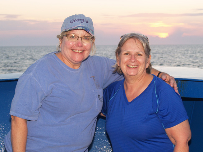
Vicki Albritton (left) and JoCasta Green
The partnership between UGA Skidaway Institute and i2STEM is expected to grow. Five additional doliolid cruises are scheduled this year with space available for as many as four teachers on each cruise. UGA Skidaway Institute will also offer two half-day cruises this month as part of i2STEM’s summer professional development workshop for teachers.
According to Frischer, the ultimate goal of scientific research is to generate and communicate information. “Teachers are some of our most important communicators,” he said. “They communicate to the next generation, so I think it is really special to be able to bring teachers right to where the research is happening. It gives them a total perspective, not only on what we are doing, but how research works and to communicate that to their students.”
Both Green and Albritton said they would encourage their fellow teachers to take advantage of opportunities like this. “You would be crazy not to, in terms of learning and what you can bring back to the kids in your classroom,” Albritton said. “It’s an experience you will never forget.”


