Tag Archives: gliders

Skidaway researchers utilize gliders to aid North Atlantic right whales

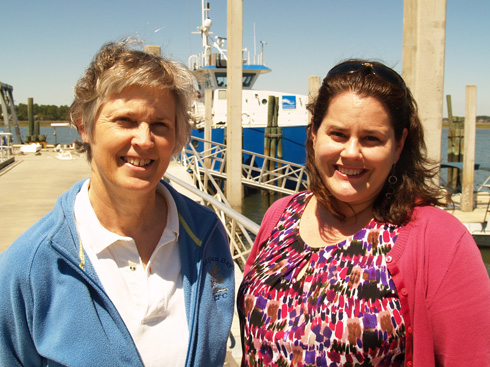
Scientists at the University of Georgia Skidaway Institute of Oceanography and the University of South Carolina are using underwater robots and artificial intelligence to help save endangered North Atlantic right whales. The project is led by Skidaway researcher Catherine Edwards and U.S.C. researcher Erin Meyer-Gutbrod.

A North Atlantic right whale mother with calf. (Photo courtesy NOAA)

Scientists believe there are only approximately 340 North Atlantic right whales remaining in the species. The whales are injured and killed from entanglements with fishing gear, lobster pots and other ocean longlines, as well as from being hit by ships.

“One main hazard to them along their migration path is shipping vessel strikes that injure and kill a number of right whales each year,” Edwards said. “Unfortunately, they’re not reproducing fast enough to counteract the harmful effects humans are having on the population. So, each year they decline and decline.”

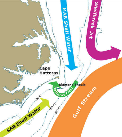
The whales spend the warm months in areas around the Gulf of Maine, Scotian Shelf and the Gulf of St. Lawrence, before migrating in the winter to their calving grounds off Florida, Georgia and South Carolina to give birth. During this migration, they are susceptible to ship strikes, especially near busy ports like Charleston, South Carolina, and Savannah, Georgia. Larger vessels are supposed to slow to 10 knots during the migration season to allow them to spot and avoid the whales, however recent studies have shown that many vessels don’t comply with this speed limit.

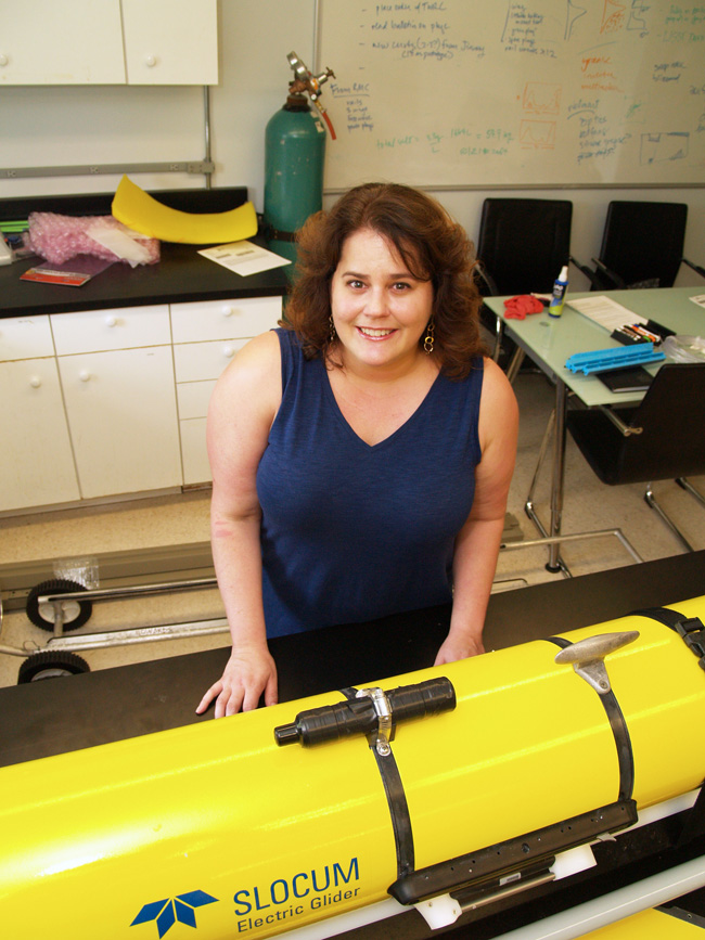
The researchers’ primary goal is to identify and locate migrating whales and alert ships to their proximity. Edwards, Meyer-Gutbrod and their team are using autonomous underwater vehicles, or “gliders,” fitted with hydrophones to listen to the whales’ vocalizations.

A newly launched glide still tethered to the boat.

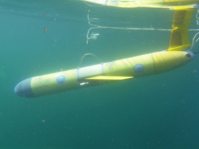
Gliders are torpedo-shaped crafts that can be packed with sensors and sent on underwater missions to collect oceanographic data. Equipped with satellite phones, the gliders surface periodically to transmit recorded data to base stations on land. Since they move through the water by adjusting their buoyancy instead of using a traditional motor and propeller, they require very little power and can remain at sea for days or weeks at a time. They are also very quiet, making them a good tool for this type of mission. The team has deployed one glider south of Savannah to detect the whales on their northward trek in the spring and will deploy another north of Charleston during the fall south-bound migration.

“Passive acoustic monitoring is a really valuable tool for monitoring baleen whales, such as right whales, because it is often less expensive than visual observations, and data can be collected 24/7 and in bad weather,” Meyer-Gutbrod said. “Gliders have been used with increasing frequency over the past decade to record baleen whale vocalizations and send alerts back in near real-time, however they really haven’t been tested or used in the waters off the southeast U.S. until now.”

The gliders will be complemented by three stationary hydrophone moorings which will also listen for whale vocalizations. The researchers will be able to compare what is heard by each of the instruments.

“I would like to compare the glider-collected acoustic data with archival acoustic data collected with bottom-mounted hydrophones to assess the glider’s detection capabilities in this environment,” Meyer-Gutbrod said.

Picking up whale vocalizations is only part of the solution. Researchers will use a low-frequency detection and classification system developed at Woods Hole Oceanographic Institution to identify the species of baleen whale that made the sounds.
“If a glider hears a sound, it matches it against a library of known whale calls for right whales and other species, and there’s an automated detection that tells the glider, ‘Hey, we just saw something,’” Edwards said.

Meyer-Gutbrod and her students then review and verify that the call is a likely detection based on a small subset of data sent each time that the glider comes to the surface.

The gliders will be positioned to pick up the whale vocalizations and send alerts about every two hours before the whales enter high-traffic areas near the ports of Charleston and Savannah. The detections will be communicated to ship captains by the management and conservation apps Whale Alert (www.whalealert.org) and Whale Map (https://whalemap.org). The researchers hope information on verified whale detections will give the ships the incentive to take protective action, like slowing down to less than 10 knots.

Beyond looking for whales, scientists hope to answer many other research questions about this technique.

“How shallow do the gliders need to get to actually hear the whales? How much background noise do we hear from other things in the environment? Or from human activities? And how much does noise from the glider itself interfere with our ability to hear whale calls?” Edwards said. “And also, how close to you have to be to actually hear them?”

The researchers also want to study recent changes in whale migration patterns. A decline in the food supplies during the summer months has triggered a shift in the North Atlantic right whale’s foraging grounds from the Gulf of Maine northward to the Gulf of St. Lawrence. While surveys have documented this shift, scientists have not yet assessed its impact on winter migration patterns.

The project is funded by a $196,847 grant from the Broad Reach Fund.

UGA Skidaway Institute researchers probe complex Atlantic Ocean currents

Dana Savidge

The ocean off the coast of North Carolina has a complex system of ocean currents that make it one of the least understood areas on the U.S. Eastern Seaboard. University of Georgia Skidaway Institute of Oceanography professor Dana Savidge is leading a team of scientists, including UGA Skidaway Institute scientist Catherine Edwards, working to unravel the mysteries of the complex ocean currents near Cape Hatteras.

The four-year project, informally called PEACH: Processes driving Exchange At Cape Hatteras, was launched in early 2016 and is funded by a $5 million grant from the National Science Foundation to better understand the relationship between the waters of the continental shelf and the deep ocean.

“The U.S. continent, like others, has a shallow ocean immediately around it, called the continental shelf. It’s like an apron that extends out from the shoreline and it is fairly shallow, only about 60 meters deep,” Savidge said. “At its outer edge, the bottom drops sharply into the deep ocean, which can be miles deep.”

Exchange at the shelf edge can push cold, nutrient-rich water from the deep ocean onto the shelf, which drives productivity of marine algae and the food web that it supports.

“There’s a reason people love offshore fishing at the edge of the Gulf Stream,” said Edwards. “Areas with regular exchange of shelf and deep waters are often known hot spots for commercial and recreational fishing.”

One reason Cape Hatteras attracted the researchers’ attention is that two opposing deep ocean currents collide there, making the ocean there highly dynamic. The warm Gulf Stream hugs the edge of the continental shelf as it flows north from the tip of Florida. At Cape Hatteras, the Gulf Stream opposes a colder current, the Slope Sea Gyre current, that moves southward along the mid-Atlantic coast. There, the Gulfstream breaks away from the coast toward northern Europe.

There is a convergence of shelf currents at Cape Hatteras as well, as cool shelf waters of the mid-Atlantic continental shelf meet the warm salty shelf waters from the south. Each of these currents, on the shelf and at the shelf edge, has a distinct temperature, salinity, and often a biological signal that reflects the origin of the water it carries. The team will measure these properties and ocean currents to better understand the exchange processes.

During the first year of the study, the researchers prepared and installed a network of sophisticated, high-tech instruments on the shore and in the ocean to monitor and capture the movement of water and changing properties like temperature and salinity. Together with scientists from the University of North Carolina and North Carolina State University, the team has worked with ocean models to better understand the interaction between shelf currents and the deeper currents of the Gulf Stream and the Slope Sea Gyre.

“Circulation on the continental shelf and the deep ocean can be quite separate things, but their effects on one another can be quite complicated,” Savidge said.
In addition to subsurface packages moored on the sea floor, the PEACH team is taking advantage of modern sampling techniques with shore-based radar systems and autonomous underwater vehicles called gliders to collect data remotely.

Savidge working on a radar antenna on the Outer banks.

Savidge’s hardware contribution to the project is a series of low-power, high-frequency radar stations that scan the waters of the continental shelf and measure the speed and direction of surface currents.

“Measuring surface currents remotely with the radars is a real advantage here,” Savidge said. “They cover regions that are too shallow for mobile vehicles like ships to operate, while providing detailed information over areas where circulation can change quite dramatically over short times and distances.”

An array of radar antennae on an Outer Banks beach.

Savidge’s research technician, Gabe Matthias, installed the radar systems on the beach at Salvo and Buxton, and at the airports at Frisco and Ocracoke, North Carolina. Currently, the researchers are working out the bugs in the system and getting the four stations to work together to paint a composite picture of the surface currents. The radars produce a massive amount of data to be processed.

Edwards leads the effort to use gliders that will operate on the shelf for nearly the entire 16-month experiment. Gliders are shaped like torpedoes and equipped with sensors to measure properties like temperature, salinity and dissolved oxygen. They can be programmed to cruise the underwater environment for weeks at a time, surfacing at regular intervals to transmit its collected data via a satellite phone.

Edwards in her lab with a glider.

Edwards’s specialty is improving the way these gliders sample the coastal waters using information from models and real-time data streams, including surface currents from Savidge’s HF radar. Edwards and doctoral students Qiuyang Tao and Mengxue Hou, co-advised by Edwards and Fumin Zhang of Georgia Tech, have developed new systems that optimize the path of the gliders based on near real-time information about current patterns and how they are expected to change, making operations more efficient and allowing better data collection.

“The glider provides data that help explain how temperature, salinity, and density change in space and time underwater, and the HF radar provides high resolution maps of surface currents every 20 minutes,” said Edwards. “The two systems are highly complementary, and their combination provides an unprecedented view of when, where, and why there is exchange between the shelf and deep ocean.”

According to Savidge, the study should produce a greater understanding of the forces at work at Cape Hatteras with implications across a wide range of interests from fisheries management to pollution control. Microscopic marine plants, known as phytoplankton, are a vital part of the marine ecosystem. Phytoplankton are the very base of the marine food web and they produce approximately half the oxygen in the atmosphere. In addition to tracking deep water inputs that support productivity on the shelf, Savidge said, it would is also be important to understand any processes that transport carbon-rich shelf water back to the deep ocean. When phytoplankton and the rest of the food web convert nutrients into their own biomass, water returned to the deep ocean can carry large quantities of organic carbon with it.

The knowledge gathered at Cape Hatteras will be applicable to other oceans around the world.

“Cape Hatteras is the ideal place to look at these processes that you are going to find elsewhere,” Savidge said. “You have a lot of energetic forcing and everything is concentrated in a very small space, with large variations over short distances. The idea is to understand the processes so you can model them effectively. If you can do that, you can anticipate how circulation on the shelf and exchanges with the deep ocean will respond to changes in the Gulf Stream or the wind over time.”

The project will run through March 2020. The other members of the research team are Harvey Seim and John Bane of the University of North Carolina; Ruoying He of North Carolina State University; and Robert Todd, Magdalena Andres and Glen Gawarkiewicz from Woods Hole Oceanographic Institute.

Savidge expressed special appreciation to the National Park Service and the North Carolina Department of Transportation for providing sites for the radar installations, and the University of North Carolina’s Coastal Studies Institute for help in installing them.

UGA Skidaway Institute scientists study dynamic Cape Hatteras waters

Sometimes called the “graveyard of the Atlantic” because of the large number of shipwrecks there, the waters off of Cape Hatteras on the North Carolina coast are some of the least understood on the U.S. eastern seaboard. University of Georgia Skidaway Institute of Oceanography scientist Dana Savidge is leading a team, which also includes UGA Skidaway Institute scientist Catherine Edwards, to investigate the dynamic forces that characterize those waters.

The four-year project, informally called PEACH: Processes driving Exchange at Cape Hatteras, is funded by $5 million grant from the National Science Foundation. Skidaway Institute will receive $1.2 million for its part.

Researchers Dana Savidge (left) and Catherine Edwards

Researchers Dana Savidge (left) and Catherine Edwards

Two opposing deep ocean currents collide at Cape Hatteras, making the Atlantic Ocean near there highly dynamic. The warm Gulf Stream hugs the edge of the continental shelf as it flows north from the tip of Florida.  At Cape Hatteras, it opposes a colder current, the Slope Sea Gyre current, that moves southward along the mid-Atlantic coast and breaks away from the coast toward northern Europe. As in the deep ocean, the cool shelf waters of the mid-Atlantic continental shelf meet the warm salty shelf waters from the south at Cape Hatteras.

The convergence of all of these currents at one place means that, after long lifetimes in the sunlit shallow shelves, these waters may export large quantities of organic carbon—small plants and animals that have grown up on the shelf—to the open ocean. Scientists have little understanding of the details of how that happens and how it is controlled by the high-energy winds, waves and interaction the between the constantly changing Gulf Stream and Slope Sea Gyre currents.

According to Savidge, the area is very difficult to observe because the water is shallow, the sea-state can be challenging and the convergence of strong currents at one place make it hard to capture features of interest.

“It’s difficult to get enough instruments in the water because conditions change rapidly over short distances, and it’s hard to keep them there because conditions are rough,” she said. “Ships work nicely for many of these measurements, but frequently, the ships get chased to shore because of bad weather.”

To overcome the limitations of ship-based work, the research team will use a combination of both shore- and ocean-based instruments to record the movement and characteristics of the streams of water. A system of high-frequency radar stations will monitor surface currents on the continental shelf all the way out to the shoreward edge of the Gulf Stream, providing real-time maps of surface currents.

“Measuring surface currents remotely with the radars is a real advantage here,” Savidge said. “They cover regions that are too shallow for mobile vehicles like ships to operate while providing detailed information over areas where circulation can change quite dramatically over short times and distances.”

Edwards will lead a robotic observational component in which pairs of autonomous underwater vehicles called gliders will patrol the shelf to the north and south of Cape Hatteras.  Packed with instruments to measure temperature, salinity, dissolved oxygen and bio-optical properties of the ocean, both shelf- and deep-water gliders fly untethered through the submarine environment, sending their data to shore at regular intervals via satellite.

To compensate for the notoriously difficult conditions, Edwards will take advantage of a novel glider navigation system she developed with students and collaborators at Georgia Tech that automatically adjusts the glider mission based on ocean forecasts as well as data collected in real time.

“Our experiments show that we can keep the gliders where they need to be to collect the data we need,” she said. “The best part is that we get to put the maps of surface currents together with the subsurface information from the gliders, and we can make all of this information available in real time to scientists, fishermen and the general public.”

The researchers will also place a number of moorings and upward-pointing echo sounders on the sea floor. These acoustic units will track the water movement while also recording temperature and density.  PEACH will focus primarily on the physics of the ocean, but the information the researchers gather will also help scientists more fully understand the chemistry and biology, and may cast light on issues like carbon cycling and global climate change.

“Everyone is interested in the global carbon budget, and the effect of the coastal seas on that budget is not well understood,” Savidge said. “For example, many scientists consider the continental shelf to be a sink for carbon, because there is a lot of biology going on and it draws in carbon.

“However, there are indications that the shelf south of Hatteras is both a sink and a source of carbon. This project may help clarify that picture.”

The project will run through March 2020. The remaining members of the research team are Harvey Seim and John Bane of the University of North Carolina; Ruoying He of North Carolina State University; and Robert Todd, Magdalena Andres and Glen Gawarkiewicz from Woods Hole Oceanographic Institute.